sectors
Geospatial technology allows us to provide highly detailed, accurate 3D digital mapping services
GIS mapping software saves both labour time and budget. It allows employees to be more efficient when mapping out job sites due to the sheer volume of data they can access

GIS ON water supply Distribution system
GIS maps allow utilities to manage their infrastructure like never before. They can access all utility line locations, types, pipe sizes, ages, and repair information using GIS data
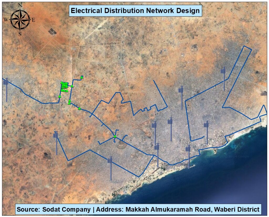
Implementation GIS ON Electric supply Distribution
GIS integration enables electrical companies to effectively manage their assets in a spatial context. By overlaying electrical infrastructure data onto accurate geographical maps, organizations can visualize and analyze the location of assets, such as power lines, transformers, and substations
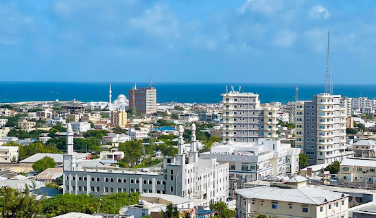
Urban Planning
Mapping is an important part of town planning. It enables the summarizing of key elements of the area, the people, topographical features, resources, and infrastructure. It provides a visual overview of an area and its specific characteristics such as roads, municipal borders, land use, zoning, and the like
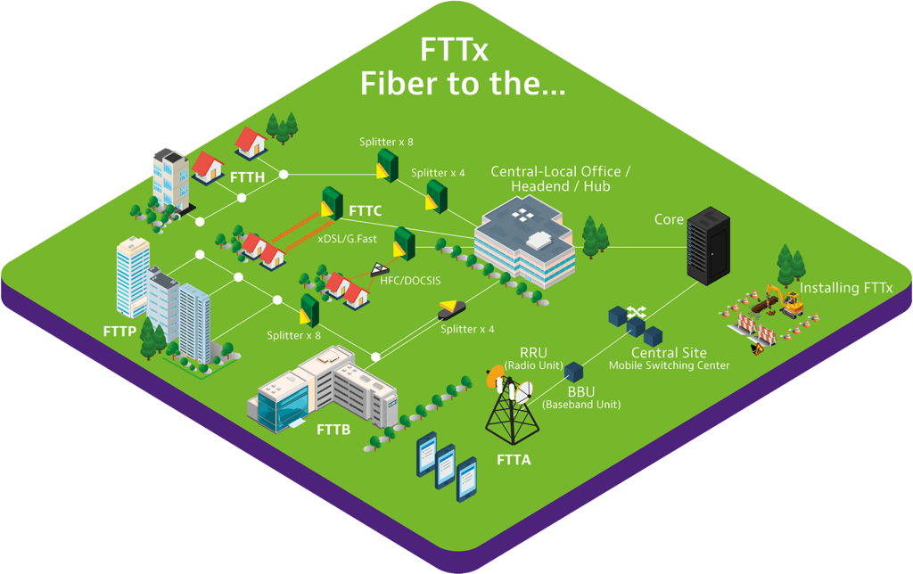
Network Infstracture and documentation
FTTx networks bring the combined advantages of higher transmission rates and lower energy consumption. Moving optical fiber closer to the user allows the latest construction, connection and transmission techniques to be leveraged to their fullest extent and diminishes the bottleneck potential of conventional coax. To make this feasible, skillful planning and execution must propagate all lifecycle phases.
Why Outdoor Adventure
Lorem ipsum dolor sit amet, consectetur adipiscing elit. Ut elit tellus, luctus nec ullamcorper mattis, pulvinar dapibus leo.
- Experience: Locavit liberioris possedit
- Reputation: Diremit mundi mare undae
- Guide Experience: Spectent tonitrua mutastis
What You Get
Lorem ipsum dolor sit amet, consectetur adipiscing elit. Ut elit tellus, luctus nec ullamcorper mattis, pulvinar dapibus leo.
- Private Hike: Locavit liberioris possedit
- Transportation: Diremit mundi mare undae
- Great Facilities: Spectent tonitrua mutastis